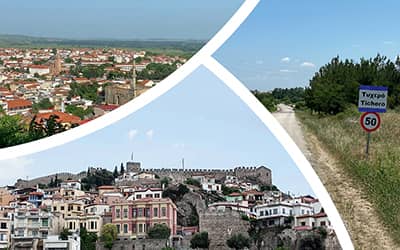
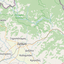
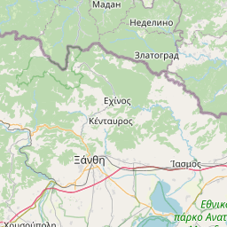
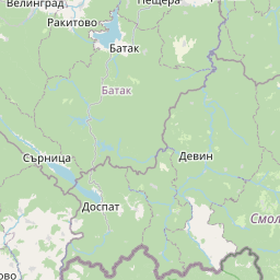
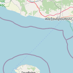
Orphic echoes

From : Petroussa
To: Kamariotissa

Route distance: ~612 kilometers 5 meters

According to the mythical tradition, people were initially taught music in ancient Thrace, the birthplace of music. This unique human invention, this art that has the power to elevate people, to give birth to and express a whole world of emotions, is closely related to the entire Region of Eastern Macedonia and Thrace.

Orpheus, the most famous musician of antiquity, was coming from Thrace. Other famous musicians, poets, and singers lived and acted here, such as Thamyris, his son Musaeus, who according to others was the son or disciple of Orpheus, Eumolpus, Philammon.

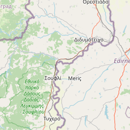
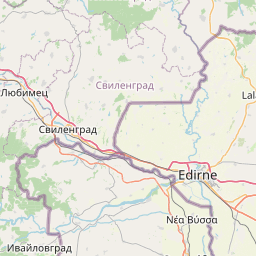
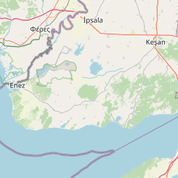
You can look for all of them on the 'Orphic echoes' route presented below, in the places to which they relate.

But you can also hear their echoes in the region’s traditional and contemporary music production, in the international Music School Festivals that take place every year, in the important personalities (musicians, poets, singers) who have been and are still creating here.

You may also like


  • Mythotopia
    Abdera
    Town on the coast of Xanthi, near the Nestos river. It is built near the ancient city of Abdera which dates from around the mid-7th century BC. According to mythology, the city was founded by Hercules in honor of his friend Abderos. Avdera was the homeland of the philosophers Democritus, Leucippus, Hecataeus, Anaxarchus, thw sophist Protagoras, and the astronomer Vion. West of the port, is Skala of Avdera with a large white sandy beach, which is an ideal destination to enjoy the sunset. On Shrove Monday, there is a kite flying competition and feast with traditional music. In the last ten days of July, Democritia cultural events take place, which last for five days.
  • Mythotopia
    Nymfea grove
    Nymfea grove is situated very close to Komotini overlooking the city. It is undoubtedly the green lung of Komotini with facilities for cultural, leisure, sports, and recreational activities. From here, the visitor can enjoy the wonderful view of the city of Komotini, the plain of Rodopi, and the Thracian Sea. The paved road that crosses the grove leads to the historic fortress of Nymfea. Recreation Grove of Komotini
  • Mythotopia
    Fossil forest of Evros
    Situated very close to Lefkimmi, the fossilized forest of Evros is one of the best-preserved forests of its type throughout Europe. This fossilized forest of rare beauty is 40 million years old and the only one in Europe with fossils that are scattered in a lush dense forest. It was created thanks to the geotectonic evolution in the Aegean combined with the intense volcanic activity that prevailed in the area million years ago. The fossil forest of Evros offers many opportunities for trekking and hiking. The landscape can be enjoyed throughout the paths and safe walking routes.
  • Mythotopia
    Ardas
    The Arda is a tributary of Evros river - the largest one. Its springs are located up the mountains of the Rhodope Mountains in Bulgaria, and most of it crosses the neighboring country. It flows eastward and enters the Greek territory from the northern part of Orestiada. Αfter bathing at the spot where the rivers Ardas, Evros and Tonsus meet, Orestes is said to have been cleansed of the crime of matricide, for which he had been pursued by the Furies. With dense forests of alders, willows, poplars, hornbeams, field elms, plane trees, and various other species of plants growing along its banks, the Arda is proved to be an important habitat of the area with rich flora.  The fauna of Arda is particularly impressive, with various species (predators, smaller birds, reptiles, mammals, and fish) finding shelter on its banks and in its waters. Over the years, large land improvement and irrigation projects have been constructed to supply the surrounding areas with water and avoid flooding. Ardas Festival takes place in the area every year. naturagraeca Municipality of Orestiada
  • Mythotopia
    Dadia
    Dadia is a settlement on the slope of Gibrena peak. It is located inside the magnificent National Park of Dadia-Lefkimmi-Soufli Forest. During the Ottoman period, the village was called Tsiam-Kebir or Tsamkioi, meaning "pine tree" in Turkish,  due to the existence of many pine trees in the area. Dadia was named after the Greek word δαδί (dadi), meaning the resin-filled wood that comes from the pine tree employed as a means of lighting and kindling. According to folk tradition, the residents of Dadia settled here to avoid an epidemic in their homeland, a city located on a hill, on the bank of the Evros, the ruins of which can still be traced at the point where the river meets the Maggazi stream.
  • Mythotopia
    Didymoteicho
    City in the region of Evros, 2 km away from the Greek-Turkish border. It was named after the double walls of its castle (Kale) or, according to another version, after the two opposite fortified cities (one on Kale and the other one on the opposite hill, Agia Petra). The city is built at the point where the rivers Evros and Erythropotamos meet, 40 km away from the Bulgarian border, and it hosts the headquarters of the Diocese of Didymoteicho, Orestiada and Soufli as well as the Muftia of Didymoteicho. The history of the city dates to the Neolithic period. It used to be the administrative and military base of the Byzantine Empire and became its capital three times. Later on, it became the first Ottoman capital in European territory. Didymoteicho was officially united with Greece by the Treaty of Sevres in 1920. Today, most of the Muslim minority belong to the Roma community. After the Greco-Turkish War (1919–1922), refugees from the Asia Minor, Eastern Thrace and Eastern Romilia settled here. There is also an Armenian community in the city. Didymoteicho has several important sights, indicative of the long history of the city. Plotinoupolis, the ancient city on the hill of Agia Petra, with impressive findings such as the Golden Bust of the emperor Septimius Severus and a Roman mosaic with mythological representations. Due to the key geostrategic position of the city, it was one of the most important cities in Thrace. It was also the birthplace of Ioannis III Vatatzis and Ioannis V Palaiologos, as well as the headquarters of the emperors Ioannis III Palaiologos and Ioannis VI Kantakouzinos. The Armenian church Surp Kevork (Agios Georgios), the Agora Gate (central castle gate), the Princess Tower, Agia Aikaterini church, the burial chapel of the Palaiologos era, the church of Christ the Savior in the Castle of Agios Athanasios, the church of the Assumption of Virgin, and several springs are some of the most interesting attractions in the city. Attractions indicative of the Ottoman history of the city include the Sandrivan or Charsi Mosque (Agora Mosque) currently the only operating mosque in Didymoteicho, the magnificent Bayazit Mosque in the central square of Didymoteicho, the Hammams of Urtz Pasha (Baths of the Whispers or Baths of Love), the Hammam Feridun Ahmed Beg and Pyrostia (Mausoleum of Oruts Pasha (turbes). The city has two remarkable museums, the Byzantine and the Folklore Museum, as well as two natural caves, the Kayali cave and the Vouva cave. Among the events that take place in the city are the bagpipe festival (Kale Panair), the “Vatatzeia”, and the “Palaiologia”. Didymoteicho is the birthplace of Byzantine emperors John III Doukas Vatatzes and John V Palaiologos, the Ottoman sultan Bayezid II, and Olympic javelin thrower Konstadinos Gatsioudis.  Municipality of Didymoteicho Traditional woman's costume from Didymoteicho (photo)
  • Mythotopia
    Egnatia highway
    It is the longest highway in Greece, 670 kilometers long. It is part of the European Route 90. It starts from Igoumenitsa in Epirus and ends at the Greek-Turkish border at Kipoi of Evros in Thrace. Its name is due to the Ancient Egnatia Road that crossed almost the same area.
  • Mythotopia
    National Park of Eastern Macedonia and Thrace
    The National Park of Eastern Macedonia and Thrace is a wetland complex that extends to about 930,000 acres. It consists of Nestos Delta as well as Vistonida and Ismarida lagoons. The national park was founded in 2008, with the view of protecting the rich flora and fauna of the area. There are two information centers for the national park: the Information Center of Lake Vistonida, at the western entrance of Porto Lagos, as well as the Information Center of the Nestos Delta, in Keramoti of the Regional Unit of Kavala. National Park of Eastern Macedonia and Thrace
  • Mythotopia
    Dadia-Lefkimmi-Soufli Forest National Park
    Located in the middle of the regional Unit of Evros, Dadia forest is part of the southeastern end of the Rhodope Mountains covering an area of ​​506,290 meters. It is at the crossroads of three countries, i.e., on the west of the main road and railway axis from Alexandroupolis to Ormenio and Bulgaria, as well as to Kipi and Turkey. It is lowland and semi-mountainous area, with an altitude ranging between 10 and 604 meters. Its highest peaks, Sapka and Silo, are located in the west and form a more mountainous landscape, which alternates with small valleys and numerous streams.  Dadia comprises the largest semi-mountainous pine forest throughout Thrace - some parts of which are over 100 years old. The forest, streams, crops, and pastures of the wider area, make Dadia an ideal environment for many species of fauna. In particular, most predators and reptiles from all over Europe have been observed in this area, as well as rare species of vulture, namely, the black vulture, the white scavenger vulture, and the griffon vulture. Since 1994, the Ecotourism Center has been established to provide accommodation, food, and a number of services (guided tours to a bird-watching observatory. etc). Hunting is strictly prohibited in protected areas of the forest. Two well-known attractions are located in the forest, the Monastery of Dadia and the Monastery of Kornofolia. Dadia forest has been designated a Natura 2000 area. National Park of Dadia Forest
  • Mythotopia
    Erythropotamos
    Erythropotamos is one of the main tributaries of the Evros river. Its sources are located on the Rodopi range, and more specifically on the peaks Korfovouni and Mati located in the regional units of Evros and Rodopi respectively. In antiquity, it was known as Erigonas, while in Bulgarian, it is called Luna Reka, which means 'the crazy river'. Since 2008, the Municipality of Didymoteicho holds a cultural festival called "Red River Cultural Festival".
  • Mythotopia
    Komotini
    City of Thrace, capital of the prefecture of Rodopi. Built in the Thracian plain, at the foot of the Rodopi Mountains, it is an important commercial, economic and transportation hub of Thrace. Thanks to its geographical location, it is also an administrative center, keeping its special character due to the presence of minorities, mainly Muslims. The original core of the city was the Byzantine fortress. Nowadays, the heart of the city is Eirini Square, and the suburb of Nea Mosinoupolis with its shopping malls and department stores. In the wider area, lies the University Campus and the Industrial Zone. The existence of the city is attested since the 2nd century AD. After the Greco-Turkish War (1919–1922), many refugees from Eastern Thrace, Eastern Romilia and Asia Minor settled here. The Muslim population was excluded from the population exchange between Greece and Turkey in the Treaty of Lausanne in 1923. Nowadays, the city is a mosaic of Christians, Muslims, Armenians, Jews, and expatriates from former Soviet Union and has a strong multicultural character. Komotini is known for its roasted chickpeas, its coffee blends and its traditional sweets (malebi, soutzouk lukum). Some districts have a special color with the minarets, the latticed windows and the public market. Important sights include the Archaeological Museum with exhibits from wider Thrace, the Folklore Museum in Peidis residence with exhibits of local folk architecture, the Ecclesiastical Museum of the Holy Diocese of Maroneia and Komotini, in the Imaret of Komotini, a typical sample of Ottoman architecture with ecclesiastical exhibits dating from the 16th century. Other sights include the Byzantine Museum, the Karatheodori Museum, the Municipal Papadriellios Gallery, the Thracian Museum of Education, the Thracian, Ethnological, Historical and Cultural Museum of Komotini and Thrace, in the neoclassical Skouteri residence, the Byzantine Fortress, the Church of the Assumption of Mary of 1800, the Eski Mosque, the Geni Mosque, the old court house, the Clock Tower, the Tobacco Warehouse at 8 Parnassos Street, the Holocaust Memorial, the World War II Memorial (Sword) and more. In Komotini the Democritus University of Thrace has its headquarters. The Pilot X Project (video)
  • Mythotopia
    Lefkimmi
    Settlement near the protected forest of Dadia, in the middle of the Evros regional unit. It was named after the numerous lefkes (meaning poplars). The village has a privileged position next to the forest and near the Evros river. Important attractions of the settlement are the church of Mary and the half-ruined mansion of Kirmizis with its traditional architecture.
  • Mythotopia
    Makri
    Tourist settlement of the prefecture of Evros. Most of the inhabitants work in agriculture and tourism. The area has been inhabited since the ancient years. It has kept its traditional character. Sights include the prehistoric mound, the cave of Cyclops with remnants of a Neolithic settlement, the hill of Prophet Elias, the 19th century church of Agia Anastasia and the Ottoman baths. EMT Greece
  • Mythotopia
    Virsini Mountains
    The Mountains of Vyrsini, also known as Megalo Livadi, is a mountain range in Thrace, on the Greek-Bulgarian border. Located between the regional units of Rodopi and Evros, it is a natural continuation of the mountain range of Eastern Rhodope to the east. To the south of the mountain range, a complex of picturesque villages known as the Pomakochoria is the homeland of the Greek Pomak community. Scattered prehistoric rock paintings have been found in an area very close to the peak Chilia. The mountains are covered with deciduous oak forests; the flora also includes species such as elms, grey alders, willows, plane trees, poplars, but also beech forests. Bellflowers, fringed pinks, various wild orchids, and violas grow here.
  • Mythotopia
    Ormenio
    Ormenio is a village in the Evros region, and the northernmost settlement in Greece. It is situated near the right bank of the river Evros, and it is the stop where the river enters Greece from Bulgaria. It was an important town of the Byzantine Empire, as evidenced by the remains of the medieval fortress. In September 1371, Ormenio and the nearby banks of Evros were the sites of the Battlle of Martisa (or Battle of Evros) between the allied Christian forces of the Balkan nations (Serbs, Bulgarians, and Greeks) and the Ottoman Empire. The former tried unsuccessfully to prevent the advance of the Ottomans in the Balkans. These efforts ended in a defeat that seriously affected the  future of the Byzantine Empire. The Byzantine general Belisarius was born in Ormenio. Britannica ERT news
  • Mythotopia
    Paranesti
    Village of the region of Drama, next to the river Nestos. The village has special natural beauty, rich flora and fauna. There are also ruins of ancient monuments and arched bridges and churches. JTI Target (video)
  • Mythotopia
    Kamariotissa-Chora on the bike
    Ride your bike comfortably on the road that connects Kamariotissa with Chora. The traffic is never heavy, while you can also find several springs to ease your thirst along the way.
  • Mythotopia
    Sericulture
    Soufli is the city of silk. The silkworm breeding started from Edirne and continued around Evros river and the area of Soufli, whose inhabitants began to deal with silk as producers, workers and traders. In the early 1880s the city became an important sericulture center. Every year, from May to June, the city pulsated to the rhythms of silk and silkworm rearing. Most part of the house of most inhabitants of the city was shaped based on the needs of sericulture. Nowadays, the silk produced in Soufli is of high quality. Visit Thraki
  • Mythotopia
    Soufli
    Soufli is the “City of Silk” and is built 500 meters from the Evros. It was named after the tradition of the wise hermit Sofoulou (Sofou means "hermit" and Sofoulou means "hermitage"), who was alone in the area. According to another version, Soufli was named after groups of people from Souli, who left their land and settled in the area. The city is famous for its silk, and has many silk factories. In its museums, you can see the history of the city as well as the history of the silk. The houses, known as koukoulospita, are traditionally made of wood and stone and they are built to serve the needs of sericulture. Municipality of Soufli (video)
  • Mythotopia
    Platanotopos cave
    North of the settlement at the foot of the Paggaio Mountain there are many caves and rock shelters. The Platanotopos Cave consists of two chambers. Its interior was in use in ancient times as ceramic sherds of prehistoric and historical times have been found. It is not an archeological site open to visitors.
  • Mythotopia
    The Trypes of Mary cave  
    In the devotional cave of the Virgin Mary In the  proximity of the southeastern houses of the settlement of Moustheni, at the southern foot of Mount Paggaio, the 'Trypes" (holes) of Virgin Mary cave is located. The cave has three entrances and is used as a place of worship. It had a similar religious use in the past. According to local traditions, the cave communicates internally with the Monastery of Panagia Eikosifoinissa located at the northern foot of Paggaio near Nikisiani. It is speculated that the three cave openings may have been mining galleries from antiquity.  Ministry of Culture 
  • Mythotopia
    Stavroupolis
    City next to the Nestos. It is a tobacco cultivation center and has several old stone houses with architectural interest as well as newer ones with neoclassical influences. Here you can find opportunities for kayaking, car racing, climbing, archery, etc. It is the place of origin of Katerina Sakellaropoulou, president of Greece. Municipality of Xanthi (video)
  • Mythotopia
    Nestos Straights
    The impressive relief of a river The Straits of Nestos is a narrow valley or wide gorge formed by the flow of the waters of the river Nestos. It extends parallel to the riverbed of Nestos, occupying approximately 23,800 acres, between the settlements of Stavroupoli and Toxotes. The impressive relief of the area, with steep rocky areas and caves, and the intense meanders of the river create a natural landscape of special beauty. The Straits of Nestos are an important habitat with a great variety of flora and fauna. It is an area of ​​exquisite beauty. It has been designated as a NATURA 2000 area. Within this magnificent landscape, almost on the edge of the rocks and parallel to the riverbed, the railway line crosses a magnificent landscape. The line connects Thessaloniki with the towns of Thrace. Apart from the train, however, a path suitable for hiking links the settlement of Galani with Stavroupoli and Leivaditis. Visitors to the Nestos Straits are lucky, since in several parts there are opportunities for canoeing, kayaking, rafting, ziplining, and hiking in an environment of incomparable beauty. Suggestions for Canoe Kayak and Rafting in Drama Nestos-Rodopi trail (topoguide) Municipality of Nestos (video)
  • Mythotopia
    Toxotes
    Settlement in the region of Xanthi. After the Treaty of Lausanne, refugees from Eastern Thrace and Asia Minor settled here. The name of the village (meaning "archers") probably came from its older name, Oxylar, from the Turkish okcu, which means "archer". The area is ideal for alternative tourism and activities such as canoeing, climbing, archery, cycling and walks along the Nestos. The route (Stavroupolis-Toxotes) is easy and the descent takes about 4.5 hours. During the descent, the visitor has the opportunity to enjoy the natural landscape and to observe the birds. Visit Thrace  
  • Mythotopia
    Chrysoupolis
    Chrysoupolis is a town in the center of Nestos plain and the center of agricultural production in the wider area. Its name means "golden town". Various agricultural products are grown in large areas around the town, and livestock breeding is equally developed.  Visit Kavala
x
This site is using cookies to ensure that we give you the best experience on our website. If you continue by pressing the "Accept" button, we assume that you consent to receive all cookies on Mythotopia
Accept