Route's points of interest
You may also like
Abdera
Town on the coast of Xanthi, near the Nestos river. It is built near the ancient city of Abdera which dates from around the mid-7th century BC. According to mythology, the city was founded by Hercules in honor of his friend Abderos. Avdera was the homeland of the philosophers Democritus, Leucippus, Hecataeus, Anaxarchus, thw sophist Protagoras, and the astronomer Vion. West of the port, is Skala of Avdera with a large white sandy beach, which is an ideal destination to enjoy the sunset. On Shrove Monday, there is a kite flying competition and feast with traditional music. In the last ten days of July, Democritia cultural events take place, which last for five days.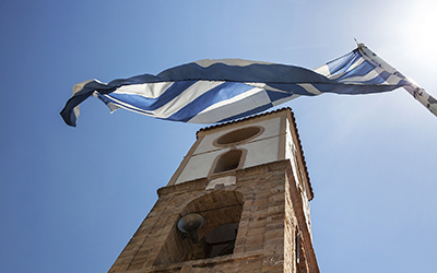
Agia Paraskevi (Abdera)
The old church of Agia Paraskevi was rebuilt in 1845 after its destruction due to an earthquake.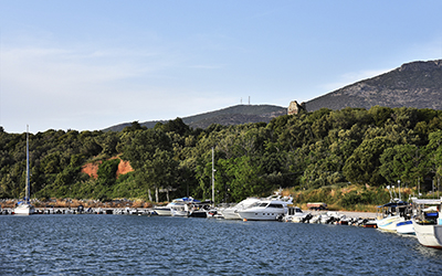
Agios Charalambos
Agios Charalambos is the port of Maroneia, approximately 4 km south of the town. Some traces of the ancient port are still visible. EMT Greece The Pilot X Project (video)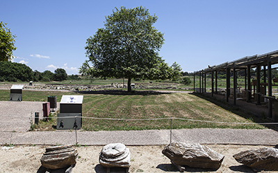
Ancient Abdera
From Abderos to Abderitism Abdera was founded in the middle of the 7th century B.C. by settlers from Klazomena, a city in Asia Minor, led by Timisios. The great obstacles that the settlers had to face, the conflicts with the native Thracians and malaria, did not contribute to a smooth development. In the middle of the 6th century, in 545 BC, a second organized colonization was attempted by the inhabitants of Teos, the Greek city on the Erithrean peninsula in Asia Minor. In this operation according to the myth, the settler was Heracles who founded the city to honor his friend and son of Hermes, Abderos. The hero Abderos had helped Heracles in one of his 12 labors, the abduction of the man-eating horses of the king of the Viston Thracians, Diomedes, and according to the legend, the wild horses had devoured him. Although there were the same problems with the first colonization, this time the Teians overcame them. Utilizing the fertile land, the two natural ports and the geographical position in general, Abdera developed into an important city of the North Aegean. The city minted a coin around 540 BC., a sign of economic growth. Many ancient writers such as Pindar, Herodotus, Hippocrates, Thucydides, Diodorus of Sicily and Pliny the Elder have mentioned in their works the city of Abdera from where we learn a lot about its evolution. Among other things, we learn from historical sources that Xerxes encamped in Abdera in 480 and 479 BC. during his campaign against the Greeks. Apart from the economic, the cultural development of the city was also great. The Greek philosopher of the 5th c. BC Leucippus came from Abdera, as well as his student Democritus. They developed the theory that matter is made up of atoms. In addition, the sophist and teacher Protagoras (490 BC - c. 420 BC) also lived in Abdera. The attacks by the Thracian tribe of Triballi, in 376 BC and later by Philip II, king of Macedonia, in 350 BC in combination with the alluvium of the river Nestos, imposed the transfer and creation of a new city further south. This new city was built according to the Hippodamian plan. According to this, straight roads intersect vertically, creating building blocks and spacious squares. The locations of public buildings, residences and temples were defined. In addition to road construction, the city had walls, two ports, an acropolis and a theater. During the 1st century AD, the walls were destroyed, and the city fell in decline. In the 4th century AD, the small town moved further north to the hill of the ancient city and was named Polystylos, where it remained until the 14th century AD. Historical testimonies and sources are confirmed by archeological excavations that have brought to light various private and public buildings and cemeteries. The ancient city was to become known for "Abderitism", the naivety and misery of its inhabitants, which may have been due to diseases and high fever from the swampy areas near Abdera. Ministry of Culture JTI Target (video)
Via Egnatia
On the road artery of Macedonia and Thrace In the middle of the 2nd century BC. when Macedonia was a Roman province and new provinces were created further east, the construction of new road networks and the development of existing ones was deemed necessary to connect Rome with all its territories. Thus, in Macedonia and Thrace the road network which already existed from the Archaic era (7th-6th century BC) and was developed later by the Macedonian kings, had to be modernized and expanded. This work was completed by the viceroy of Macedonia Gnaios Egnatios, between the years 146 and 120 BC, after whom the road took its name. It started from Apollonia (the ancient colony of Corinth and Corfu, founded in the early 6th century BC) and Dyrrachium in Illyria (present-day city of Durrës, Albania) and ended in Byzantium, an old colony of Megara (founded in the 7th century BC), today's Istanbul, Turkey. It essentially connected the Adriatic with the Black Sea and remained in use in the following centuries until the Ottoman period. The length of ancient Egnatia road from the Adriatic to Evros River was 861 kilometers or 535 miles and for the most part, in prefectures of Xanthi and Rodopi, is visible along the modern Egnatia motorway. Parts of it can be seen and are preserved in good condition in Philippi, in Kavala, from the settlement of Stavros to the national road Drama - Kavala to the junction of Makedonias and Egnatia streets, near the Egnatia Hotel. From the existence of stations and towers related to road safety and services, it passed through Akontisma where the traces of a fortress for the control of the Egnatia road are preserved, from Topeiros, Xanthi, Palia Morsini and Petrochori as well as the villages of Semeli and Ageli. To the east, parts of it can be seen after Alexandroupolis and Traianoupolis. More specifically, on the borders of the Prefectures of Rodopi - Evros, mountainous parts were located in the area of Komaros, northeast of the archeological site of the Zone. In the prefecture of Evros, three lowland sections of Via Egnatia are preserved next to the old national road, 3 km. east of Alexandroupolis and Traianoupolis to the settlements of Maistros and Apalo. Egnatia Motorway S.A.
Ancient Maroneia
Ancient Maroneia, the jewel of Rodopi In the Odyssey Homer mentions the mythical Thracian hero Ismarus, the land of the Cicones (Kikones) where Maron was the priest of Apollo. Tradition claims the priest to be the chief of settlers (founder) of the colony founded by the inhabitants of Chios, in the middle of the 7th century. BC, after whom the city took its name. Various historical sources testify the economic development of the city, its annexation to Macedonia in the 4th century BC. and its prosperity during the Roman period. Archaeological research in the area that lies between the beach of Agios Charalambos and Mount Ismaros has revealed ruins belonging to ancient Maroneia. One of the most important is the fortified acropolis in Ai-Giorgis. Agios Georgios which dates back to the 9th-8th c. BC. with a gate made of granite, as it is testified by the monolithic pilasters. The citadel is identified with the city of Cicones' Ismara or Ismaros. Some of the most important sites in the area are from the 4th c. BC the sanctuary attributed to the god Dionysus, the city walls with a total length of 10 km, the house with mosaic floors, as well as other building complexes. From the Roman Period are the Roman Agora of the city and the Roman propylon from the time of Emperor Hadrian (124-125 AD). South of the settlement of Maroneia, in "Kampana", the ancient theater is situated. The first human presence in the wider area is evident in the Cave of Cyclops Polyphemus and dates to the Neolithic period (5,300-3,800 BC) and the early Bronze Age. Ministry of Culture Diazoma EMT Greece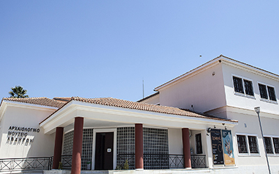
Archaeological Museum of Abdera
Abdera comes alive through the findings of the excavations The findings of the perennial excavations of the ancient city of Abdera and its cemeteries are exhibited in the Archaeological Museum. Through the thematic units of public and private life as well as burial customs, the evolution of Abdera and human activity from the 7th century BC until the 12th century AD are presented. Explanatory texts, maps and photographs accompany the archeological findings, aiming at the best possible presentation to the visitors, as well as educating the students on the local history with educational programs carried out in a specially designed area. Ministry of Culture Greek Archaeological Museums JTI Target (video)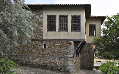
Tavaniotis mansion
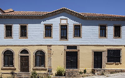
The traditional mansion Tavaniotis in Maroneia The Tavaniotis mansion, built between 1880 and 1885 by Parrasios Tavaniotis, is a jewel for the settlement of Maronia. The two-story mansion is a brilliant example of local architecture. In its rooms and spaces it houses findings from excavations in the surrounding area in a comprehensive exhibition on the theme: "Maroneia and Ismaros from Prehistoric to Modern Times". The exhibition of antiquities is enriched with texts and photographs for a better understanding of the history of the area. Greek Archaeological Museums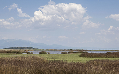
Vistonida
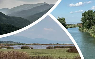
On the border of the regional units of Xanthi and Rodopi, lake Vistonida (or Bistonis) is one of the most well-known lakes in Greece with a very interesting history. It was named after the city of Vistonia (or Bistonia), which was founded by the mythical Biston, and was the home of the Bistones. The lake is mentioned by many writers, geographers, and travelers. Access to the lake is from the nearby villages of Selino, Nea Kessani, Koptero, Salpi, Nea Kallisti and Glykoneri. It is the fourth largest lake in Greece covering an area of 45 square kilometers, with an average depth of about 4 meters. It is part of a complex of wetlands and part of the National Park of the Nestos Delta; Vistonida and Porto Lagos are considered as top ecotourism destinations in Greece. It is a brackish lake that is fed by the rivers Kosynthos, Kompsatos, and Aspropotamos. It ends in small lagoons, some of which are used for fish farming. To the south, it is separated from the Thracian Sea and the Vistonic Gulf by a narrow strip of land, where the wetlands of Porto Lagos extend; to the north, the lake reaches almost to the foot of the Rhodope Mountains. The wetland complex is protected by the Ramsar Convention. In Vistonida you will find an ideal place for observing various bird species all year round. Out of 260 species, 9 are rare or endangered, such as the white-headed duck and the lesser white-fronted goose.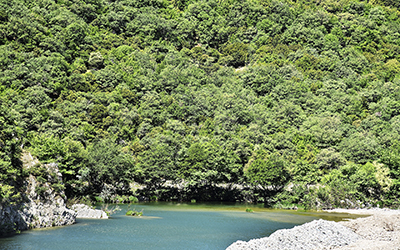
Kompsatos bridge
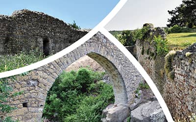
The Medieval bridge on the Kompsatos A stone Byzantine bridge is preserved between the settlements of Iasmos and Polyanthos. It is attributed to craftsmen from Epirus and dates back to the 15th century. The bridge is oriented West-East. Initially it had three arches but today only the eastern and middle arches that were the highest are still standing. The surviving arches have an opening of 21.80 m. and a height of 17 m., respectively, while the height of the middle one is 12 m. The pillars of the bridge bear relieving openings. The bridge was built at a strategic point as ancient ruins have been found in the area and the Byzantine castle of Polyanthos is also further to the North. JTI Target (video) The Pilot X Project (video)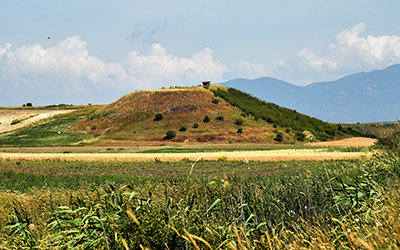
National Park of Eastern Macedonia and Thrace
The National Park of Eastern Macedonia and Thrace is a wetland complex that extends to about 930,000 acres. It consists of Nestos Delta as well as Vistonida and Ismarida lagoons. The national park was founded in 2008, with the view of protecting the rich flora and fauna of the area. There are two information centers for the national park: the Information Center of Lake Vistonida, at the western entrance of Porto Lagos, as well as the Information Center of the Nestos Delta, in Keramoti of the Regional Unit of Kavala. National Park of Eastern Macedonia and Thrace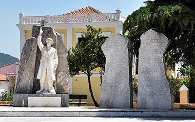
Iasmos
One of the oldest towns in the regional unit of Rodopi. Its Christian and Muslim inhabitants work mainly in agriculture and livestock breeding. The stone arched bridge of the 17th–18th century on the Kompsatos river, the church of Agios Ioannis Prodromos of the 18th century, and Thracian Meteora, a natural landscape of unique beauty are the tourist attractions of the area.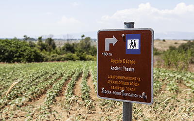
Poroi Castle
The ruins that can be seen near the settlement of Porto Lagos belong to the Byzantine fortification of Poroi. Although only 170 meters of the enclosure survive today, it is estimated that its extent was much greater. The towers and stairs leading to the perimeter wall are visible. The name derives from the passage from the Thracian Sea to Lake Vistonida. This was the reason why it developed significantly as it played an important role commercially and strategically. The foundation of Poroi dates back to the 9th or 10th century. It was destroyed by the Bulgarian Tsar Ivan I known as Kalogiannis or Skylogiannis. The final abandonment of the settlement came in the 14th century. Kastrologos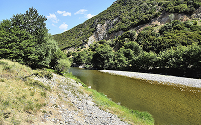
Kompsatos
Kompsatos is a river flowing in Thrace. It originates from the Rhodope Mountains and the area of Echinos. After following a course of 68 kilometers between steep and inaccessible slopes, it ends in the plain of Xanthi and finally flows into the northern part of Lake Vistonida. According to some scholars, Kompsatos has been identified with the river Kossinitis, which is mentioned in literary works of antiquity. According to mythology, Diomedes' horses turned wild after drinking water from this river. Kompsatos is an important habitat with a rich fauna of about 130 species of birds, some of which are threatened with extinction. Between the villages of Iasmos and Polyanthos, the visitor arrives at the stone bridge over Kompsatos, known as Polyanthos bridge, an Ottoman arched bridge that dates back to the 15th century.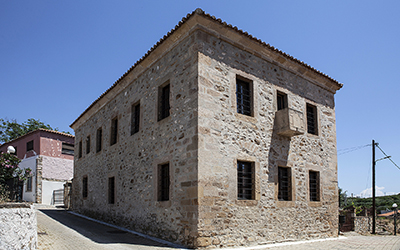
Folklore Museum of Abdera
The Folklore Museum of Abdera, on its two floors, hosts exhibits dating from 1830 to 1850, covering two thematic sections: rural life, and the art of weaving. On the ground floor of the museum, agricultural tools, household utensils and small furniture are exhibited, while on the second floor, visitors can admire examples of weaving such as carpets, embroidery, clothing, handicrafts and decorative ornaments. The museum is housed in the restored building of the old primary school, which was built around 1860 and is located next to the village church. It is a unique neoclassical building made of stone and wood. JTI Target (video)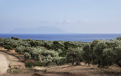
Maroneia olives
Medium-sized round olives from the region of Maroneia with a characteristic bittersweet taste. They are edible but can also be used to produce oil.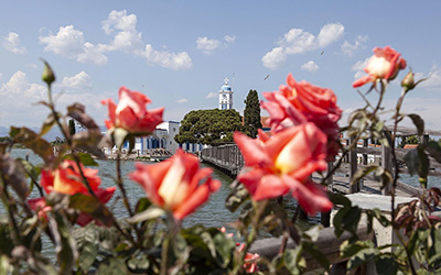
Agios Nikolaos monastery (Porto Lagos)
Located on the islet of Lake Vistonida or Bourou, near the settlement of Porto Lagos, Agios Nikolaos is a dependency (metochion) of the sovereign Vatopedi Monastery on Mount Athos. It is connected to the mainland by a wooden bridge and has a small guesthouse. A small brotherhood, originating from the Vatopedi Monastery, operates daily. On December 6th, the feast day of Saint Nicholas, visitors gather here to celebrate. The establishment of the monastery is associated with certain traditions. According to the first one, the area around Vistonida was granted to Vatopedi Monastery by the Byzantine emperor Arcadius, and the monastery of Agios Nikolaos was established as an expression of gratitude to the Virgin Mary for his salvation from a shipwreck near Vatopedi. The second tradition refers to the miraculous rescue of the sick daughter of an Ottoman landowner by an Orthodox hermit who was in the area of Porto Lagos. To thank God for his daughter's rescue, the grateful father donated his land in the area for the establishment of a Christian monastery. JTI Target (video)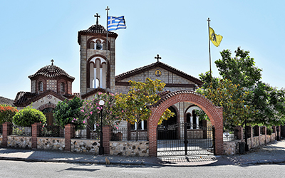
Nea Kessani
Village in the Abdera Municipality, very close to Vistonida. It is one of the few villages in Thrace where the custom of Babo (Gynaikokratia) is still celebrated every year on the 8th of January. Thracian Electronic Thesaurus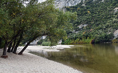
Nestos
The Nestos river is the natural western border of Thrace. Its springs from Rila mountains in Bulgaria, crosses the mountains between Orvilos and Rodopi, and flows along the Thracian Tempi from Stavroupoli to Toxotes into the Thracian Sea. It is 234 km long. From Toxotes to its estuary, at a length of 27 km, the Nestos meets Kotza Orman, one of the most significant riparian water forests in Europe. The Nestos Delta is a wetland of international importance. The river was worshiped as a sacred river by the Thracians and mentioned by ancient writers such as Herodotus, Thucydides, and Ptolemy. Nestos river and its delta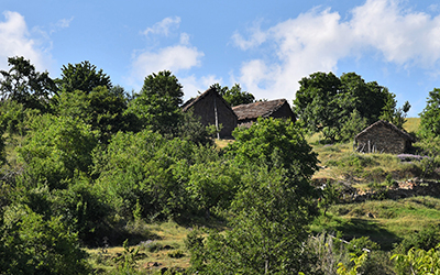
Virsini Mountains
The Mountains of Vyrsini, also known as Megalo Livadi, is a mountain range in Thrace, on the Greek-Bulgarian border. Located between the regional units of Rodopi and Evros, it is a natural continuation of the mountain range of Eastern Rhodope to the east. To the south of the mountain range, a complex of picturesque villages known as the Pomakochoria is the homeland of the Greek Pomak community. Scattered prehistoric rock paintings have been found in an area very close to the peak Chilia. The mountains are covered with deciduous oak forests; the flora also includes species such as elms, grey alders, willows, plane trees, poplars, but also beech forests. Bellflowers, fringed pinks, various wild orchids, and violas grow here.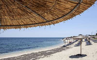
Abdera Beach
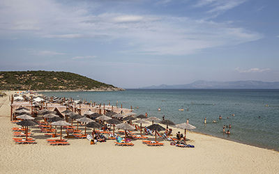
Sandy 550 meters long beach with grass and bushes that grow sporadically. Algae live in its deep sea. Choose Abdera beach if you want to swim in calm waters. Although there are not many tourist facilities, the beach is popular with the locals and, apart from swimming, you can also fish. You can combine your swim with a visit to the nearby ancient Abdera. Greek Bathing Water Profiles Registry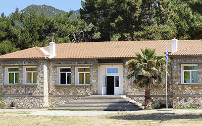
Polyantho
Village of the region of Rodopi, at the foot of the Rodopi mountain range, next to the river Kompsatos. Very close to the village ruins of a Byzantine castle were found (Polyanthos castle) as well as a stone bridge (Polyanthos bridge).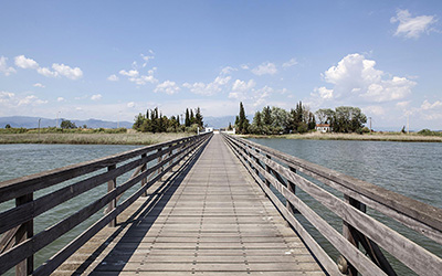
Porto Lagos
Village on the border of Xanthi and Rodopi, at the point where Vistonida lake joins the Thracian Sea. It is a famous fishing site, although not as rich as it used to be. The main species are the sea bass and the sand steenbras. Good news for bird watchers, as the surrounding pines are filled with herons. The area is also suitable for cycling or walking, as there are bike lanes, dirt roads and paths. Of course, you can have great boat trips, too. The Pilot X Project (video)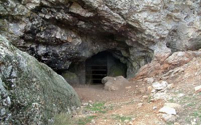
Cyclops Polyphemus cave
A cave out of the Odyssey! The cave is 350m long with width ranging between 15 and 50 m. There are two openings for entering. The cave is interesting for its stalactite and stalagmite relief but also for its connection with Homer's Odyssey. Specifically in rhapsody i352-452 Homer refers to the Kikones and Maron, the priest of Apollo in the city of Ismaros. Human presence is testified in the cave, though not continuous. The first evidence of use comes from the Neolithic period and the early Bronze Age, whereas the last dates to the Byzantine, towards the late 12th and 13th c. AD. The organized settlement in this period is justified by the upheavals in the Byzantine Empire due to civil wars between the emperors and the attacks by the Catalans on the coast of Thrace. The excavations brought to light burials and many sherds from commercial wine amphorae from the late antiquity, so the cave would have served for storage. Ministry of Culture
Platanotopos cave
North of the settlement at the foot of the Paggaio Mountain there are many caves and rock shelters. The Platanotopos Cave consists of two chambers. Its interior was in use in ancient times as ceramic sherds of prehistoric and historical times have been found. It is not an archeological site open to visitors.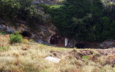
The Trypes of Mary cave
In the devotional cave of the Virgin Mary In the proximity of the southeastern houses of the settlement of Moustheni, at the southern foot of Mount Paggaio, the 'Trypes" (holes) of Virgin Mary cave is located. The cave has three entrances and is used as a place of worship. It had a similar religious use in the past. According to local traditions, the cave communicates internally with the Monastery of Panagia Eikosifoinissa located at the northern foot of Paggaio near Nikisiani. It is speculated that the three cave openings may have been mining galleries from antiquity. Ministry of Culture
